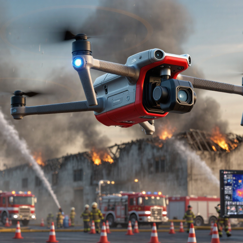
| Thermal-Imaging Multirotor | Long-wave infrared sensing, commonly 7.5–14 μm; radiometric models record temperature values for each pixel. | Locating people, hidden hot spots, roof fires, smoldering material, and heat paths through smoke. | Provides a clear heat map when visible-light cameras are obscured by darkness or smoke; can support search, overhaul, and hotspot verification. | Heavy smoke, reflective metal, steam, and incorrect emissivity settings can reduce temperature-measurement accuracy. |
| High-Resolution Visual Camera System | 4K-class video is widely used; stabilized gimbals commonly provide optical and digital zoom functions. | Incident documentation, visual reconnaissance, structural observation, and coordination of crews around the fire perimeter. | Delivers real-time situational awareness and supports post-incident review without exposing personnel to unnecessary hazards. | Performance decreases at night, in dense smoke, during precipitation, or when the lens becomes contaminated. |
| Heavy-Lift Water or Suppressant Drone | Payload capacity varies widely; compact systems may carry several liters, while specialized aircraft can carry tens of liters. | Applying water, foam, retardant, or other approved suppressant to small fires, elevated structures, inaccessible areas, and wildfire edges. | Can deliver a targeted suppressant dose to locations that are unsafe or difficult for ground crews to reach. | Payload weight sharply reduces endurance; flight time, wind conditions, refill logistics, and local rules limit repeated applications. |
| Tethered Observation Drone | Ground-powered operation can support many-hour deployments; the tether also carries data and constrains altitude. | Continuous overwatch at large incidents, wildfires, industrial sites, and emergency staging areas. | Long persistence reduces battery-swap requirements and provides a stable elevated view for incident commanders. | Requires a ground station, suitable deployment space, tether management, and protection from strong winds or entanglement. |
| Beyond-Visual-Line-of-Sight (BVLOS) Platform | Uses approved command-and-control links, detect-and-avoid procedures, and airspace coordination; authorization is jurisdiction-dependent. | Wide-area wildfire mapping, perimeter tracking, infrastructure inspection, and operations beyond the pilot’s direct view. | Expands coverage and reduces the need to position personnel close to the hazard. | BVLOS operation is subject to aviation regulations, risk assessments, communications reliability, and emergency-airspace restrictions. |
| AI-Assisted Fire and Smoke Detection | Computer-vision models analyze visible and infrared imagery for smoke plumes, flames, heat anomalies, and changing fire boundaries. | Early detection, hotspot alerts, fire-edge monitoring, and prioritization of areas requiring human review. | Can process large image streams quickly and help operators identify changes that may be missed during prolonged incidents. | False alarms can result from dust, fog, clouds, reflections, industrial heat sources, and unusual terrain; human confirmation remains necessary. |
| LiDAR and 3D Mapping Payload | Produces point clouds and elevation models; useful mapping accuracy depends on sensor quality, flight geometry, and ground control. | Structural assessment, terrain mapping, volume estimation, burned-area measurement, and route planning. | Creates three-dimensional information for buildings, vegetation, cliffs, and damaged infrastructure, including areas with limited visual texture. | Smoke, rain, foliage density, reflective surfaces, and insufficient overlap can affect data quality; processing may require specialized software. |
| Mesh-Network and Multi-Drone Coordination | Aircraft can share telemetry, imagery, location data, and mission status through a local or cellular-connected network. | Coordinated perimeter mapping, simultaneous search sectors, relay coverage, and multi-team incident awareness. | Allows several aircraft to divide a large incident area and maintain a shared operational picture. | Interference, terrain blockage, network congestion, battery differences, and collision-avoidance requirements complicate coordination. |
| Search-and-Rescue Payload | May combine thermal imaging, loudspeakers, spotlights, microphones, and location beacons. | Finding missing people, communicating evacuation instructions, marking safe landing or access zones, and supporting disaster response. | Improves search speed and enables two-way communication in areas that may be unsafe for rescuers. | Human detection can be difficult under dense canopy, debris, smoke, or water; payload operation reduces flight endurance. |
| Obstacle-Avoidance and Autonomous Navigation | Combines satellite positioning, inertial sensors, optical flow, radar, ultrasonic sensing, or depth cameras. | Close inspection of buildings, bridges, towers, forests, and industrial facilities in complex environments. | Reduces collision risk and supports repeatable routes, automated return-to-home behavior, and precision hovering. | Smoke, dust, darkness, reflective surfaces, electromagnetic interference, and rapidly changing obstacles can degrade performance. |
| Ruggedized and Weather-Resistant Airframe | Professional systems often specify ingress protection, operating-temperature limits, wind tolerance, and redundant flight controls. | Operations in rain, dust, heat, cold, coastal air, and other demanding emergency environments. | Improves reliability and protects sensitive electronics during repeated deployments and rapid emergency response. | Higher protection usually adds weight, cost, and maintenance requirements; no rating makes a drone immune to extreme fire conditions. |
| Real-Time Incident-Command Integration | Uses encrypted video, geotagged imagery, live maps, telemetry, and standard geographic information system workflows. | Sharing aerial intelligence with command staff, dispatch centers, public-safety teams, and mutual-aid agencies. | Transforms drone footage into actionable information for evacuation decisions, resource allocation, and crew safety. | Requires interoperable software, secure communications, trained operators, adequate bandwidth, and clear data-retention procedures. |
| Rapid-Swap Battery and Charging Infrastructure | Flight endurance is commonly about 20–45 minutes for many multirotor configurations, depending on payload, wind, temperature, and battery condition. | Maintaining near-continuous aerial coverage during extended emergency operations. | Planned battery rotation, field charging, and spare power systems reduce downtime between missions. | Cold temperatures, high payloads, high winds, and battery aging reduce usable flight time; damaged lithium batteries require controlled handling. |



 © Copyright 2020 Tianjin Tanghaidongyang Valve Co., Ltd. All Rights Reserved.